

Trip Summary:
Start: Blackheath Train Station End: Mt Victoria Train Station
Total km: 27.9km
Road km: 15km (8km dirt, 6km asphalt)
River km: -
Links: Route - http://tinyurl.com/h4354b9, wildwalks: http://tinyurl.com/zln9oac
The Grose Valley is one of the true gems of the Blue Mountains where sheer sandstone walls drop into enormous ghostly blue gums (Eucalyptus deani). Such is its beauty that Charles Darwin famously described it as "stupendous… magnificent" and its conservation in 1931 helped start the environmental movement in Australia. Add to this a spattering of waterfalls, canyons, rainforest and a lovely river and you have one the best walking destinations in this part of the state.
There is however a problem… the train lines weren’t built to service the valley, and walkers reliant on public transport have a substantial road bash to each of the track heads. Resultantly, most visitors that arrive on trains head to the more accessible walks around Katoomba. Additionally, many of the tracks in the valley are one way and typically require car shuffles, increasing carbon footprints and limiting choices for lone and car free walkers. So blah blah blah, it makes for a great use of the TransScooter!
Faffy fun times
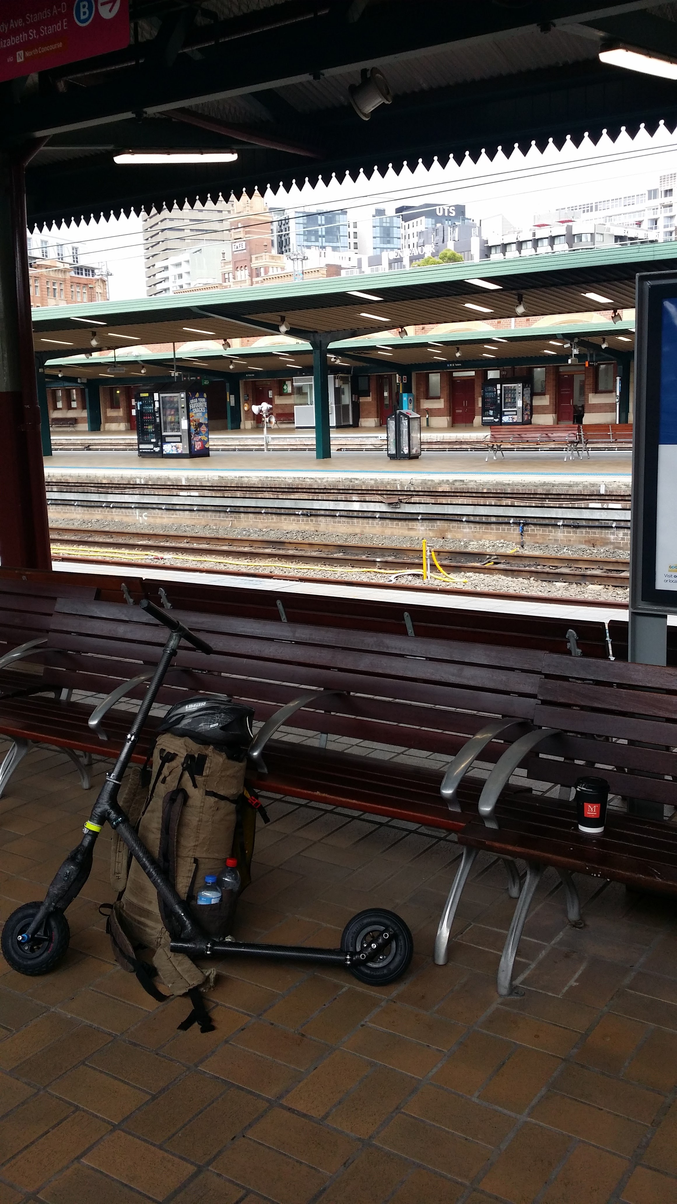
After a nice faffy morning of eggs and coffee, I collected my gear and headed towards Sydney’s Central Station to catch the 10:18 service to Blackheath. On our steady course west I settled into the familiar routine of switching between napping and reading. My ebook reader of choice (which at the time was the lightest on the market) came with an unusual constraint in the form of my allowed choice of books. Without an American credit card, I can’t purchase anything, limiting my choices to titles produced before the roaring 20’s. So after two hours with Mr Darcy (ebooks don’t have covers) I wandered off of the train into the awaiting crisp mountain air.

All stations ready
Blackheath sits at an elevation 1000m higher than Sydney and is home to a vibrant community of climbers, antique lovers and gardeners. Three of its roads branch off into the Grose Valley in varying directions and today I was headed for hat hill road, the artery to Perry’s Lookdown – the quickest and easiest access to the Blue Gum Forest. As luck would have it, the 8km of road to the track head falls over 150m making for some great scootering such that the first 3km of asphalt flew by in the first 10 minutes. After the asphalt surface gave way to a sandy rocky firetrail, it was time to let down the tires and take life at a slower pace.

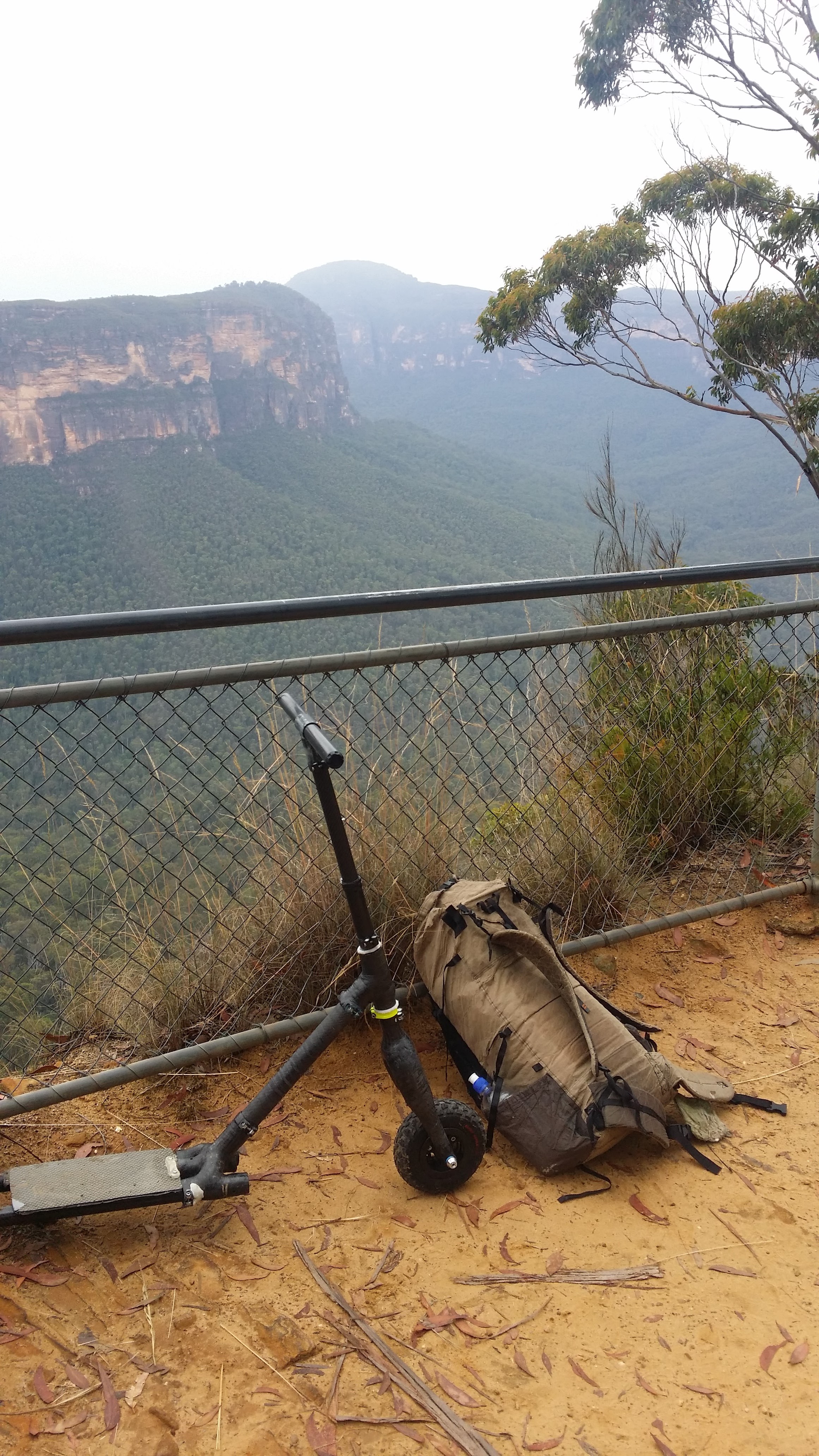
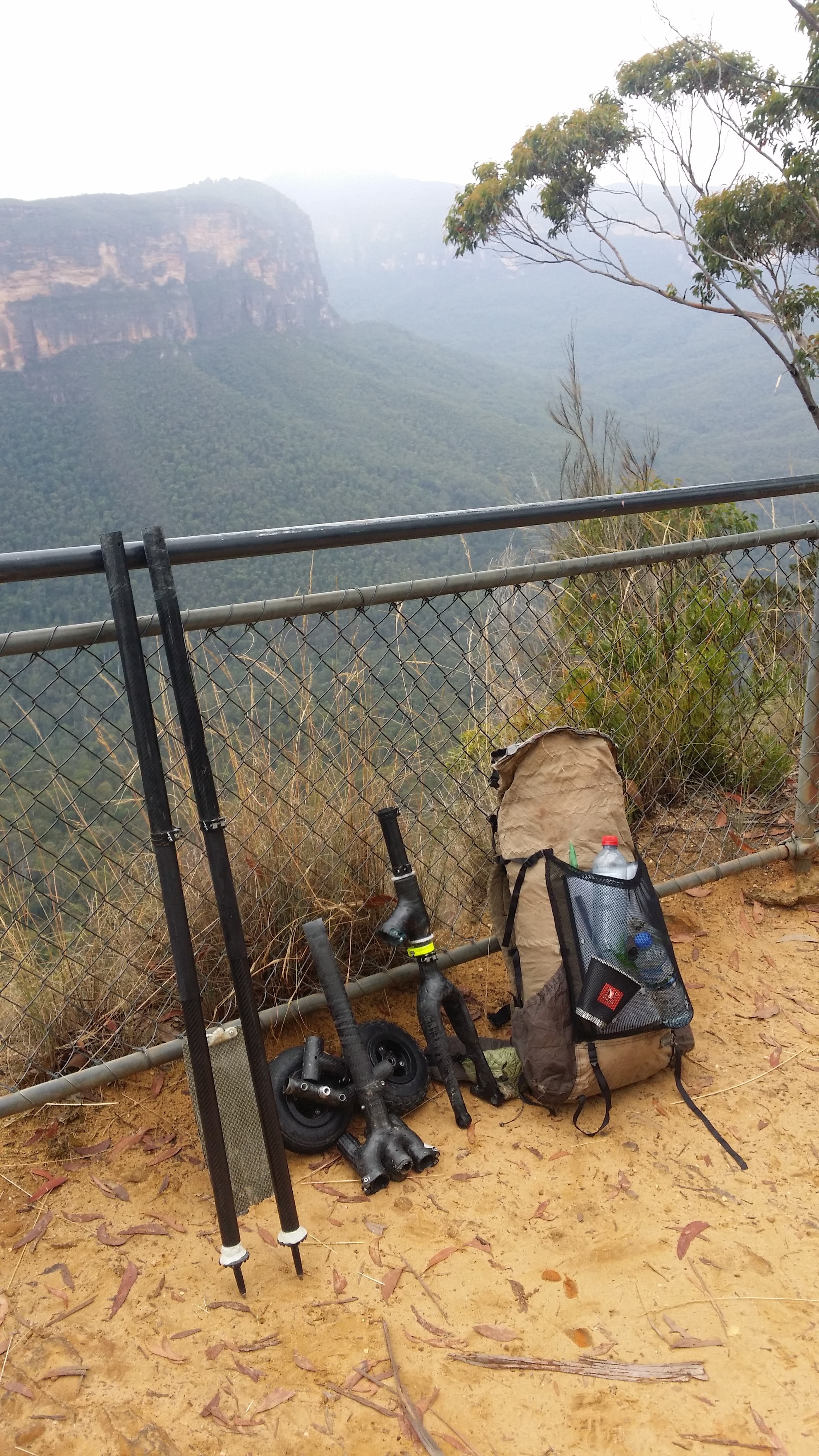
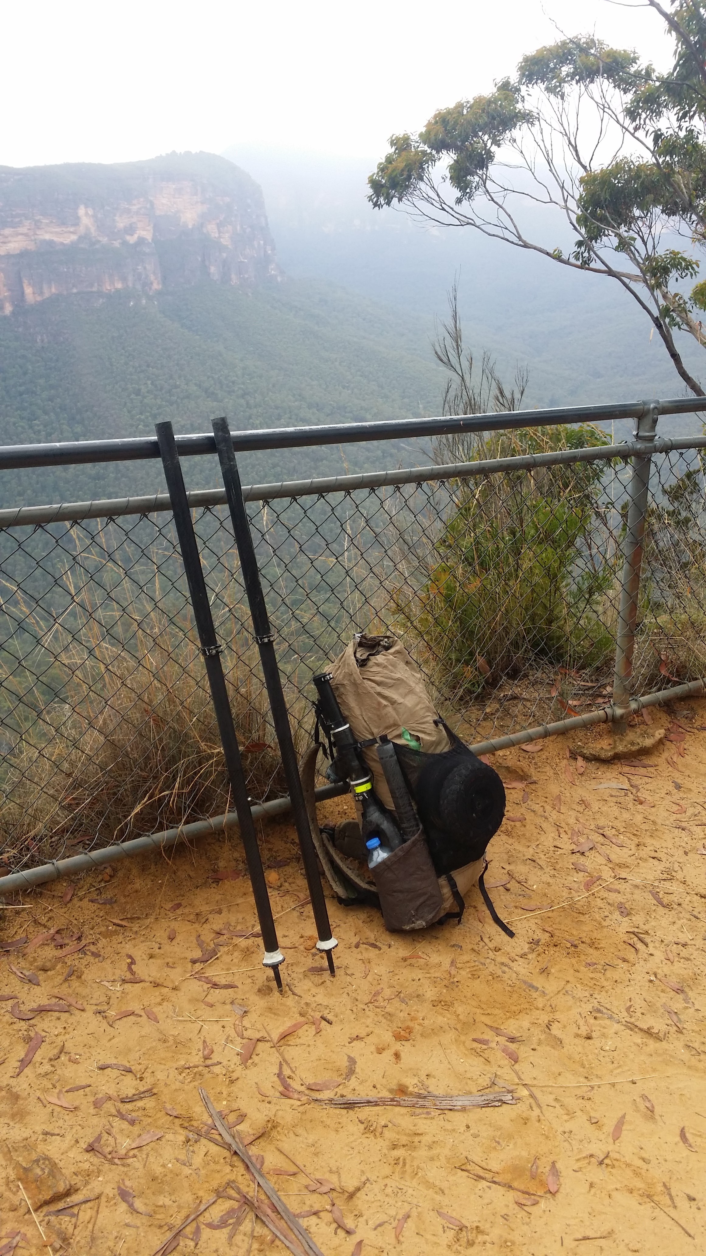
Pressure low... ready to go
After a quick snack and a couple of compulsory happy snaps it was now time for the inaugural wilderness scooter-pole transformation. All of the upper parts snapped into their desired pieces as promised on the tin, however dust and mud had worked its way into some pretty amazing places in the lower half, slowing the pace and providing some good feedback for future revisions. Despite this setback, with a little bit of tough love, everything came apart and the walking poles slipped happily together to form some solid sticks.
All of the trails into the Grose Valley are notoriously steep and the Perry’s Track is certainly no exception. From stairs to switchbacks and back again, the track sheds 600m of elevation over 2km. Thankfully about half way down the Parks service have salvaged a fallen tree into a primitive set of seats, which serve as a perfect rest point to snack and gather inspiration for the final push. Entering into the valley proper, you are first greeted by the sight of the ghostly Blue Gums, which quickly transition from marginal saplings to true giants, towering 60m in search of light – a relic of a more tropical and competitive climate.

A very big Blue Gum
The waterway is an equally delightful affair. After falling spectacularly in a series of waterfalls upstream the tea stained Govett’s Ck meanders through the Blue Gums to meet the Grose River, the mother vein draining the valley. The track now follows the river north and then west steadily tracking towards its headwaters in Mt Victoria. This junction was also the point where George Caley, the first European to attempt to cross the mountains via the Grose threw in the towel after a 10 day slog, and named most of the watershed ‘the Devils Wilderness’ in his frustration. He was only a day’s walk from the end of the mountains and 2.5km south of what is now a mountain highway.

The Grose/ Govett's confluence
So back on my mapped and trodden route, I proceeded up river for several hours settling into the routine of walking, snacking, napping and swimming. Then as the Sun was setting I rolled into camp to set up shop. Using one of my favourite shelters, the Zpacks Hexamid, I was able to find all of the necessary poles from scooter bits, saving me some time rummaging around in the bush. The hiking poles provided the structure for the front, back and left side of the shelter, while the forks formed the tie out for the right side. I have also toyed with the idea of using the axles as pegs, but in the muddy ground, chose to leave this test for another day.

TransScooter set up of Zpacks Duomid
With a restful night under my belt, I now scoffed down my hearty fruitcake breakfast and made my way up Victoria Ck, to the lookout above which signals the end of the walking leg of the journey. Thankfully, this fairly moderate climb was punctuated with numerous waterfalls, most with good swimming holes. At the top, there is a little camping area complete with bathroom and tables, making for a nice spot for the final transformation of the trip – hiking poles to offroad scooter.

Waterfall fun
The three main advantages of a scooter over a bicycle are: lower weight, less bulk and less complexity/moving parts. One of the main disadvantages of scooters in rough settings has traditionally been the lack of deck clearance. Decks low to the ground are efficient for kicking however scrape on rocks and other objects, while high decks overcome this problem, at the obvious cost of efficiency. In an effort to remedy this conflict, TransScooters have been designed to quickly alter their deck height, so you can for example travel along asphalt with low clearance and only raise the deck when road conditions deteriorate.

All the clearance
With plenty of scrapey sandstone cut outs at the start of my path home it was time to test out ‘rugged mode’. Where previously, the deck would clank against high rocks, now it was smooth sailing, all but for the odd hit to the dropouts leading up the rear. This configuration served me well for my first couple of km but then as the road became more graded it was time to again change back to ‘speed mode’ to pump out the last section into Mt Victoria. Back at the station, I collapsed the scooter and upon hitting reception, started catching up on life admin, not a problem for the original train goers who could wait in style at the now defunct Mt Victoria Train Station Bar. With my naturelust fulfilled I stepped onto the train and settled in for a nap bringing the first chapter of TransScooter tripping to close.